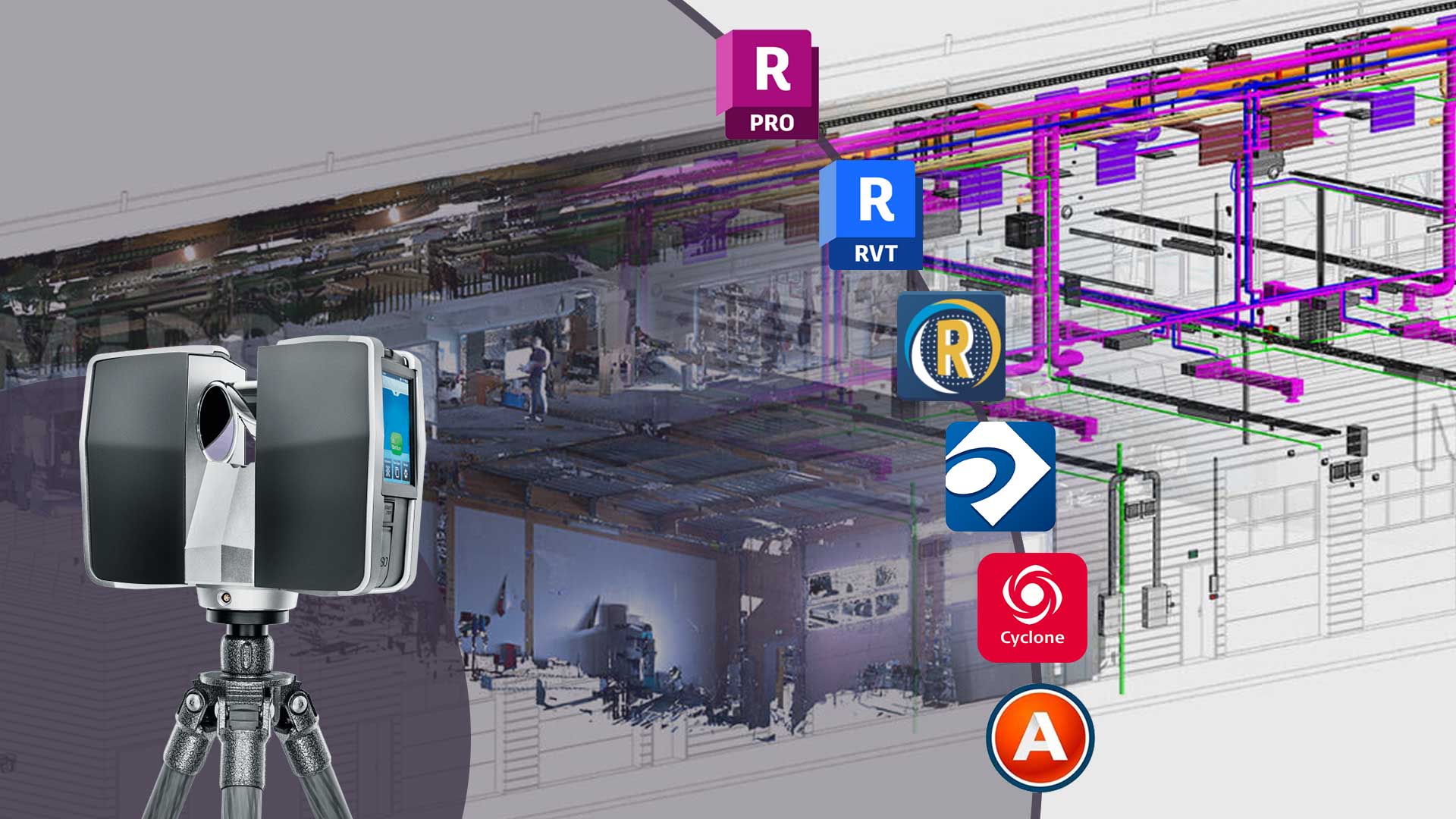
Accurate 3D modeling from point cloud survey data plays a crucial role in today’s construction and architecture projects. This process enables the creation of detailed BIM, which enhances project precision and efficiency. With a wide range of software options available, choosing the right one can be challenging. To help you make an informed decision, we’ve spotlighted some of the top BIM software that we use to provide Scan to BIM Services for converting point cloud survey data. Discover these leading solutions and see which ones could be the best fit for your upcoming projects.
1. Autodesk ReCap

Autodesk ReCap is a powerful tool for converting point cloud data into 3D models. It excels in capturing and refining reality data, making it a favorite among professionals.
Key Features:
- processes 3D scans and photogrammetry data.
- Supports large point cloud datasets.
- Allows for precise measurements and annotations.
- Integrates seamlessly with other Autodesk software like Revit and AutoCAD.
Pros:
- User-friendly interface.
- High accuracy in data capture and processing.
- Strong integration with Autodesk’s suite of tools.
- dependable documentation and client service.
Cons:
- It can be costly for small businesses.
- Requires a powerful computer to handle large datasets.
- Lacks some advanced features found in competitors.
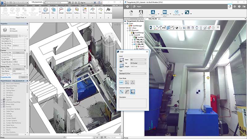
2. Autodesk Revit
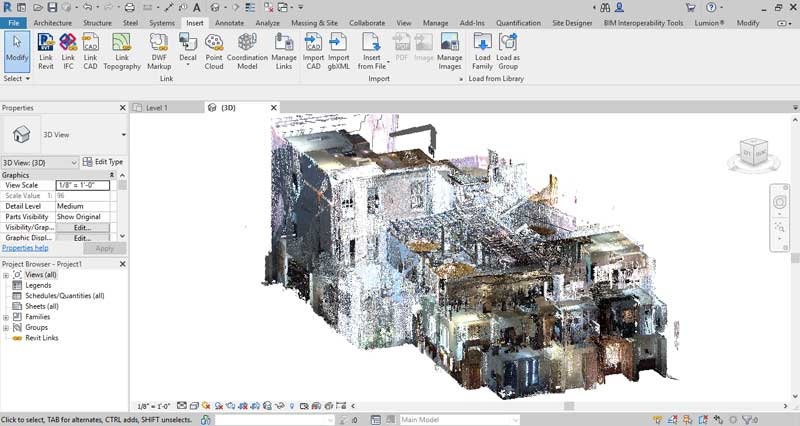
Autodesk Revit is a leading BIM software known for its comprehensive modeling capabilities. It is widely used in architecture, engineering, and construction for creating detailed 3D models.
Key Features:
- Extensive modeling tools for architecture, structure, and MEP
- Supports parametric modeling. This allows easy adjustments and modifications.
- Integrates well with a wide range of other Autodesk software and third-party tools.
- Strong support for collaboration and project management.
Pros:
- Highly accurate and detailed modeling.
- Excellent integration with Autodesk tools.
- Extensive support and training resources.
- Industry-wide recognition and support.
Cons:
- Complex and can be difficult for beginners to learn.
- High licensing and maintenance costs.
- Requires powerful hardware for smooth operation.
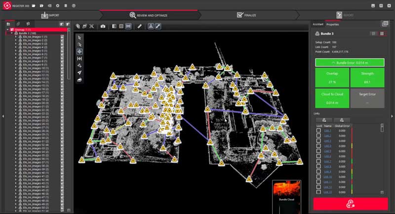
3. Trimble RealWorks
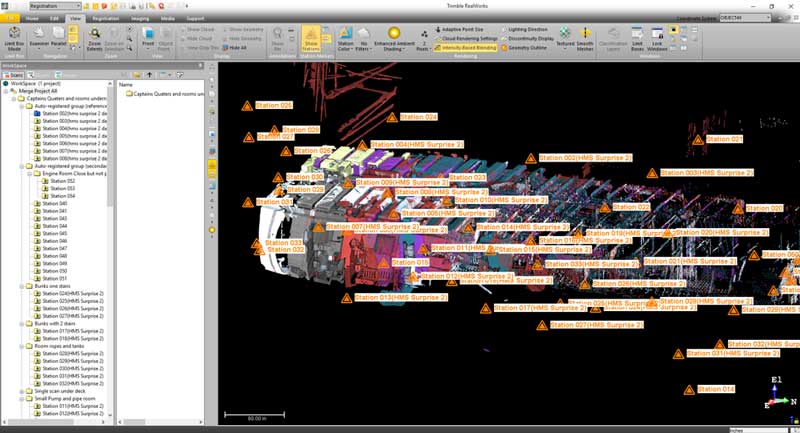
Trimble RealWorks is a point cloud processing software known for its accuracy and efficiency. It is popular in construction and civil engineering for converting scan data into 3D models.
Key Features:
- Processes and analyzes point cloud data with high accuracy.
- Supports large datasets and complex projects.
- Provides tools for measuring, annotating, and modeling.
- Integrates seamlessly with other Trimble software and hardware.
Pros:
- High precision in data processing.
- User-friendly with powerful tools.
- Excellent integration with Trimble products.
- Reliable customer support and training.
Cons:
- It can be pricey for smaller companies.
- It could be difficult for new users to learn.
- Large datasets need a powerful computer to handle them.
4. Bentley Pointools
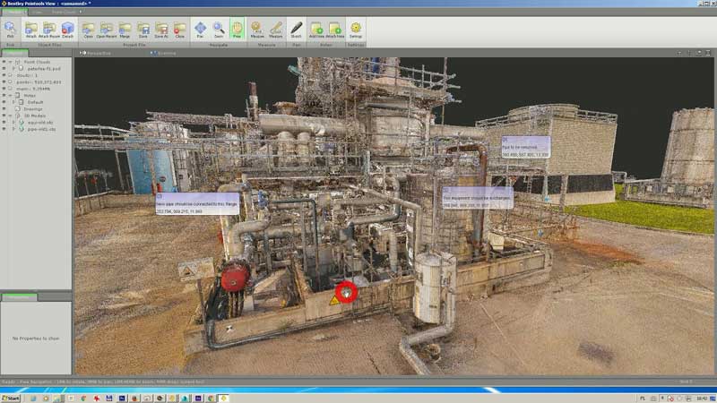
Bentley Pointools is a versatile software for point cloud data processing and modeling. It effectively manages big datasets. This makes it ideal for infrastructure and industrial projects.
Key Features:
- Efficiently processes large point cloud datasets.
- Advanced visualization and editing tools.
- Integrates well with other Bentley Systems software.
- Supports a wide range of file formats and data sources.
Pros:
- Handles large datasets effectively.
- Offers advanced visualization and editing capabilities.
- Strong integration with Bentley products.
- Excellent documentation and assistance.
Cons:
- Complex interface for new users.
- more expensive than certain options.
- Requires a powerful computer setup.
5. Leica Cyclone
Leica Cyclone is a leading software for point cloud data processing, known for its accuracy and reliability. It is ideal for detailed modeling and analysis.
Key Features:
- Processes and manages large point cloud datasets.
- Accurate tools for measurements and modeling.
- Integrates with Leica Geosystems hardware and software.
- Supports various file formats and data sources.
Pros:
- High accuracy and reliability.
- Strong integration with Leica products.
- Powerful tools for creating detailed models.
- Excellent customer support.
Cons:
- It can be expensive for smaller projects.
- Demands a large amount of computer power.
- challenging learning curve for beginners.
6. FARO As-Built
FARO As-Built is specialized software for converting point cloud data into precise 3D models. It is often used for as-built documentation and industrial plant modeling.
Key Features:
- Converts point cloud data into accurate 3D models.
- Detailed measurement and annotation tools.
- Integrates with various CAD and BIM software.
- Supports multiple file formats and data sources.
Pros:
- Highly accurate modeling capabilities.
- Excellent integration with CAD and BIM software.
- User-friendly with powerful tools.
- Excellent training and support materials.
Cons:
- It can be expensive for small businesses.
- It needs a strong computer to work well.
- Lacks some advanced features found in other options.
Conclusion
It is essential to use the right software and follow best practices to verify the accuracy of BIM models derived from building scans. Choosing the right BIM software can make a significant difference in the quality and usability of your models. By staying informed about the latest trends and advancements, you can ensure your projects benefit from the most accurate and efficient tools available.
Recent Comments