
Construction teams today face compressed schedules, increased model dependencies, and stricter quality control mandates. To keep pace, firms are shifting from manual verification to automated, high-fidelity data capture that fits directly into BIM coordination environments. The change involves both advancing technology and the evolving role of spatial data as a live, operational asset. With tools like the Leica RTC360, reality capture now initiates the construction process, forming the first link in a connected project lifecycle.
Modern field-to-office workflows rely on rapid data validation to maintain model accuracy and jobsite accountability. Instead of treating site measurements as a one-time task, project teams are using Leica Scan to BIM workflows to feed continuous updates into BIM platforms supporting model alignment, installation tolerances, and milestone tracking. When deployed strategically, scanning becomes less about documentation and more about real-time project control.
This shift requires hardware and software designed for speed, interoperability, and field intelligence. Purpose-built scanning solutions now deliver scan-and-align capabilities in real-world site conditions, supporting adaptive reuse, prefabrication validation, and in-field QA/QC. For construction professionals working across disciplines, this means faster decision-making cycles, fewer bottlenecks, and more resilient project outcomes from kickoff to closeout.

Understanding Leica RTC360: A Strategic Enabler
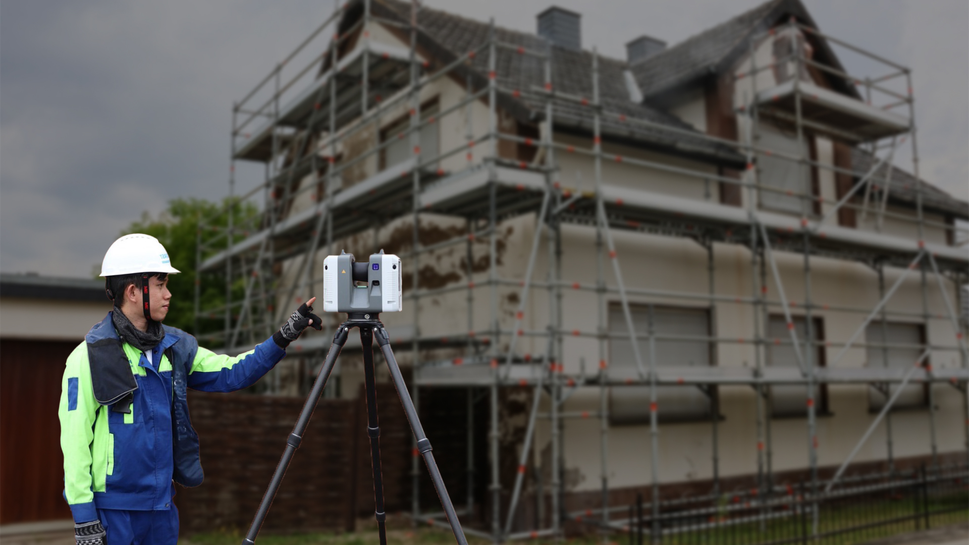
Laser scanning on construction sites is transitioning from isolated task execution to becoming a central component of integrated project workflows. The Leica RTC360 supports this transformation by offering an intelligent, field-ready solution tailored for high-frequency use in complex environments. It enables project teams to document existing conditions with millimeter-level accuracy while maintaining momentum in fast-paced schedules. With the ability to automate scan alignment and deliver structured outputs on-site, it serves as a real-time data engine that connects reality capture directly to BIM coordination, fabrication planning, and field validation processes.
Key Differentiators
- 2-minute full-dome laser scans at 2 million points per second, enabling high-throughput data capture
- Visual Inertial System: Onboard real-time scan alignment using sensor-based trajectory tracking
- Cyclone FIELD 360: Mobile-based control for live QA, pre-alignment, and metadata input during capture
- Cyclone REGISTER 360 PLUS: Streamlined registration and export directly into BIM/GIS environments
- Low-profile and portable design optimized for use across interior and exterior environments
- Direct integration with CDE platforms and digital twin pipelines for immediate downstream use
Why It Matters
The RTC360 transforms laser scanning into a dynamic field intelligence system that synchronizes design intent with physical conditions. By producing verified, high-resolution data on demand, it supports precise model alignment before construction activities begin, aids in validating installation tolerances, and contributes to faster project cycles with higher coordination confidence. It’s a technology built to keep pace with modern BIM execution plans and lean delivery models.
Pro Tip: For optimal results on complex interiors, use the VIS-enabled alignment with strategic scan stations to registration in Cyclone REGISTER 360 PLUS and minimize post-processing time.
Driving Reality-Driven BIM & Lean Construction
The Leica RTC360 serves as a direct link between site conditions and digital project execution, enabling Scan to BIM workflows that are both rapid and highly reliable. In design-intensive environments such as adaptive reuse projects or MEP-heavy structures, capturing real-world geometry with millimeter accuracy is essential for clash-free coordination. The RTC360 supports this by providing field-verified data that feeds directly into design models, allowing teams to detect and resolve spatial conflicts before fabrication or installation begins. This real-time connection between physical conditions and model-based coordination strengthens BIM accuracy and eliminates the need for assumptions during critical planning phases.
The RTC360 enhances lean construction strategies by enabling teams to track progress, validate installation tolerances, and communicate spatial issues visually within minutes. Its high-speed scanning and automated registration eliminate delays associated with traditional survey methods, allowing project managers to set reliable milestones and drive pull planning with confidence. On-site deviation checks become part of daily workflows, accelerating QA/QC cycles and supporting field teams with actionable insights. Whether used during preconstruction, installation, or commissioning, the RTC360 aligns tightly with lean principles by promoting continuous flow, informed decision-making, and real-time feedback across disciplines.
Software Ecosystem from Field to Cloud
The RTC360 operates within a performance-driven software ecosystem that aligns tightly with BIM coordination and field validation workflows. Cyclone FIELD 360 enables field teams to control scan sequencing, perform in-field QA, and tag context-specific metadata ensuring that every scan supports downstream design and coordination. Once data is captured, Cyclone REGISTER 360 PLUS handles structured registration and direct export into Revit, Navisworks, and IFC environments, allowing BIM managers to integrate point clouds into clash detection and LOD modeling with minimal delay.
Through Reality Cloud Studio, scan data becomes immediately accessible to remote teams for real-time visual validation and collaborative markup, keeping the model environment synchronized with on-site progress. Compatibility with Autodesk Construction Cloud, Trimble Connect, and other CDEs ensures scan data flows directly into model coordination, fabrication review, and progress tracking environments without extra conversion or file handling.
NOTE: This integrated pipeline reduces manual handoffs and accelerates design validation during active project phases.
Cross-Industry Applications That Prove the Vision
Built Environment / Construction
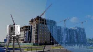
The RTC360 enables field teams to perform rapid capture of site geometry for integration into BIM-based coordination models. Its ability to support phased documentation allows for precise validation of spatial tolerances, installation tracking, and QA/QC workflows across vertical and horizontal structures.
Heritage & Cultural Preservation
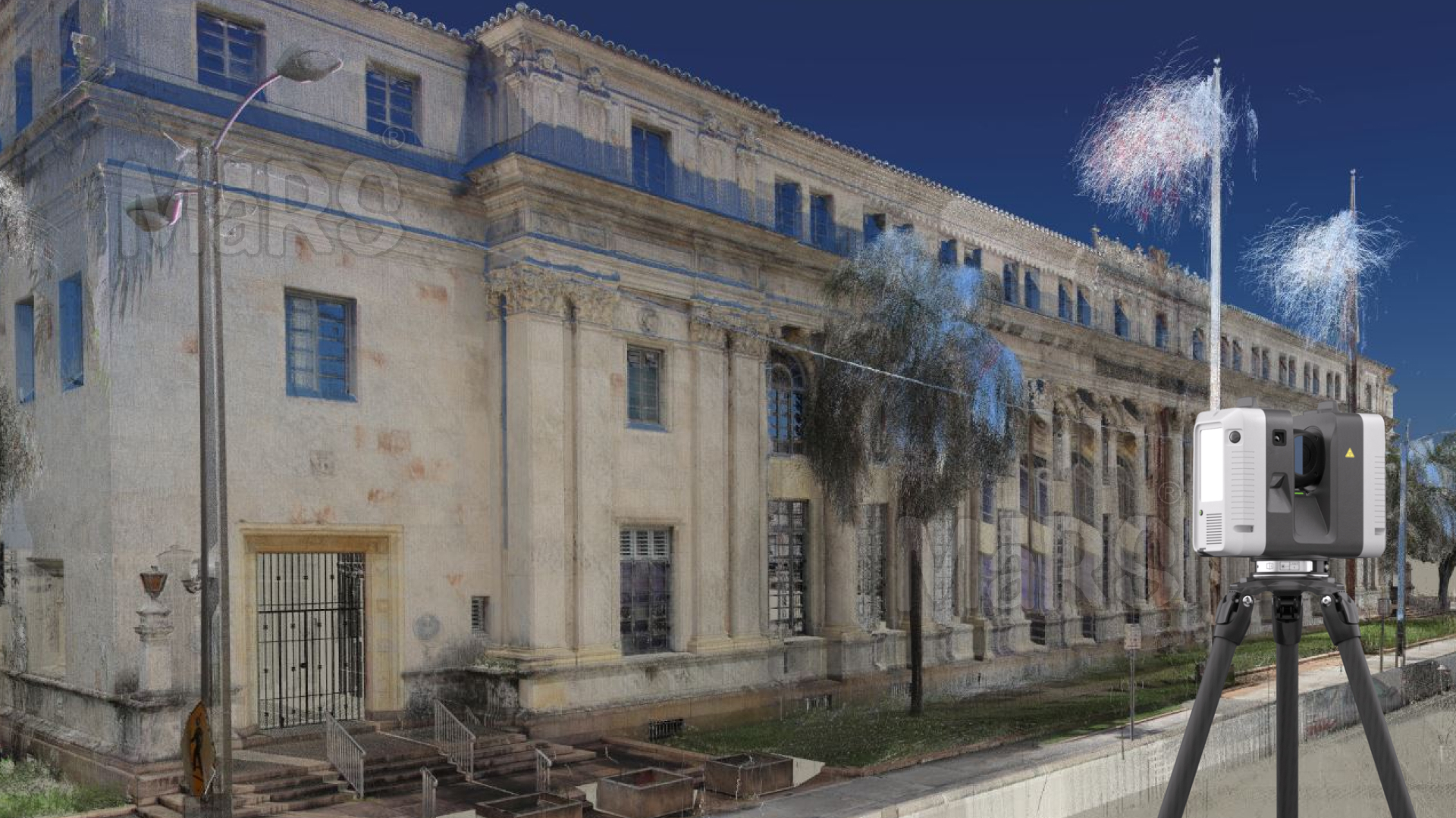
Architects and documentation specialists use the RTC360 to generate high-resolution scans of historical structures, capturing intricate detailing and irregular geometries with minimal field time. These digital records support preservation planning, structural assessments, and digital archiving initiatives.
Public Safety & Emergency Response
Reality capture professionals rely on the RTC360 to document incident environments quickly and comprehensively. The scanner’s rapid deployment and full-color point cloud output provide spatial clarity required for site analysis, reconstruction modeling, and situational reporting.
VFX & Media Production
Creative teams in visual effects and production environments use the RTC360 to capture real-world sets, props, and large-scale environments for digital asset creation. Its precise geometry capture supports virtual production, scene augmentation, and real-time rendering with minimal cleanup.
Yacht Racing & Sports Engineering
Engineers and technical consultants use the RTC360 to record detailed profiles of complex surfaces, such as racing hulls and high-performance structures. These point clouds feed into simulation models for performance analysis, optimization, and regulatory validation.
Co-Development and Field-Driven Innovation
The RTC360 continues to evolve through direct input from industry practitioners who manage high-precision data capture in active project environments. Field teams have contributed to enhancements in registration workflows, automated alignment, and user interface design. Optimizing performance for on-site reality capture and structured data delivery. This continuous exchange between users and developers ensures that each software update and hardware refinement addresses practical needs while aligning with digital construction standards, allowing professionals to work with greater consistency and project clarity.
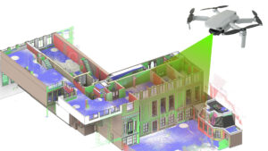
Building Digital Twins and Lifecycle Value
RTC360-generated data is structured to support object-level accuracy, enabling direct integration with asset-rich BIM environments. This allows digital twins to reflect geometry and actionable context, such as system zones, equipment identifiers, and maintenance zones, linked to physical spaces. Field-verified scans provide spatial certainty at turnover, forming a trusted foundation for downstream applications like commissioning models, CAFM systems, and asset compliance reporting.
In active facilities, this information becomes important for lifecycle planning. Scans can be referenced for space optimization, infrastructure retrofits, and renovation sequencing without needing repeated on-site surveys. As building systems evolve, the RTC360 enables teams to maintain a high-fidelity baseline for tracking physical-to-digital changes over years, supporting better forecasting, cost modeling, and operational coordination.
Business Impact: ROI, Predictability, and Scalability
- Verified site conditions captured pre-design eliminate interpretation gaps and support accurate scope definition.
- Structured scan data linked to spatial locations allows coordination teams to review deviations by system, zone, or trade.
- Automated registration and clean export pipelines reduce manual processing time and increase modeling throughput.
- Integrated scan checkpoints during installation enable spatial alignment before concrete pour, hangers, or envelope closures.
- Digital QA snapshots generated per milestone allow teams to validate construction status without delaying schedules.
- Project templates and scan protocols can be standardized across teams, ensuring consistency across multiple project sites.
- Scan-to-asset handoff models support downstream FM integration, warranty tracking, and retrofit readiness.
- Real-time scan access from cloud platforms allows stakeholders to validate field progress without traveling to the site.
- Time compression between scan and coordination review supports faster decision cycles and leaner workflows.
- Increased data confidence at turnover positions owners for data-driven facility management and operational forecasting.
Industry Future-Proofing and Beyond AEC
RTC360’s data structure, automation logic, and device interoperability position it for long-term use in spatial intelligence workflows beyond traditional construction. Its scan outputs are optimized for integration into simulation platforms, asset analytics engines, and immersive planning environments. It supports everything from virtual commissioning in infrastructure to spatial indexing in large-scale industrial facilities. Designed with edge-to-cloud processing in mind, the system supports scalable data environments where geometric fidelity, temporal tracking, and multi-format exports are essential to cross-discipline collaboration.
Conclusion
RTC360 contributes directly to the evolution of project intelligence by linking spatial accuracy, automation, and cloud-ready workflows into one continuous pipeline. It empowers AEC teams to build verified models, manage change with clarity, and maintain data continuity from design through operations. As spatial data becomes a long-term asset, project deliverable, and tool like RTC360, it sets the foundation for scalable digital practices across construction, asset management, and immersive planning environments. To evaluate its role in your workflow, explore purpose-built demonstrations or speak with implementation experts who understand the intersection of scanning and strategy.


Recent Comments