Surveyors and BIM modelers are both key players in the construction and design industry. Surveyors gather and provide the physical measurements and data needed to create accurate site models. BIM modelers use this data to build and manage detailed digital representations of buildings. When these two professionals work together effectively, they can achieve remarkable results. Collaboration between them helps ensure that projects run smoothly, stay within budget, and meet all quality standards.
Understanding the Roles
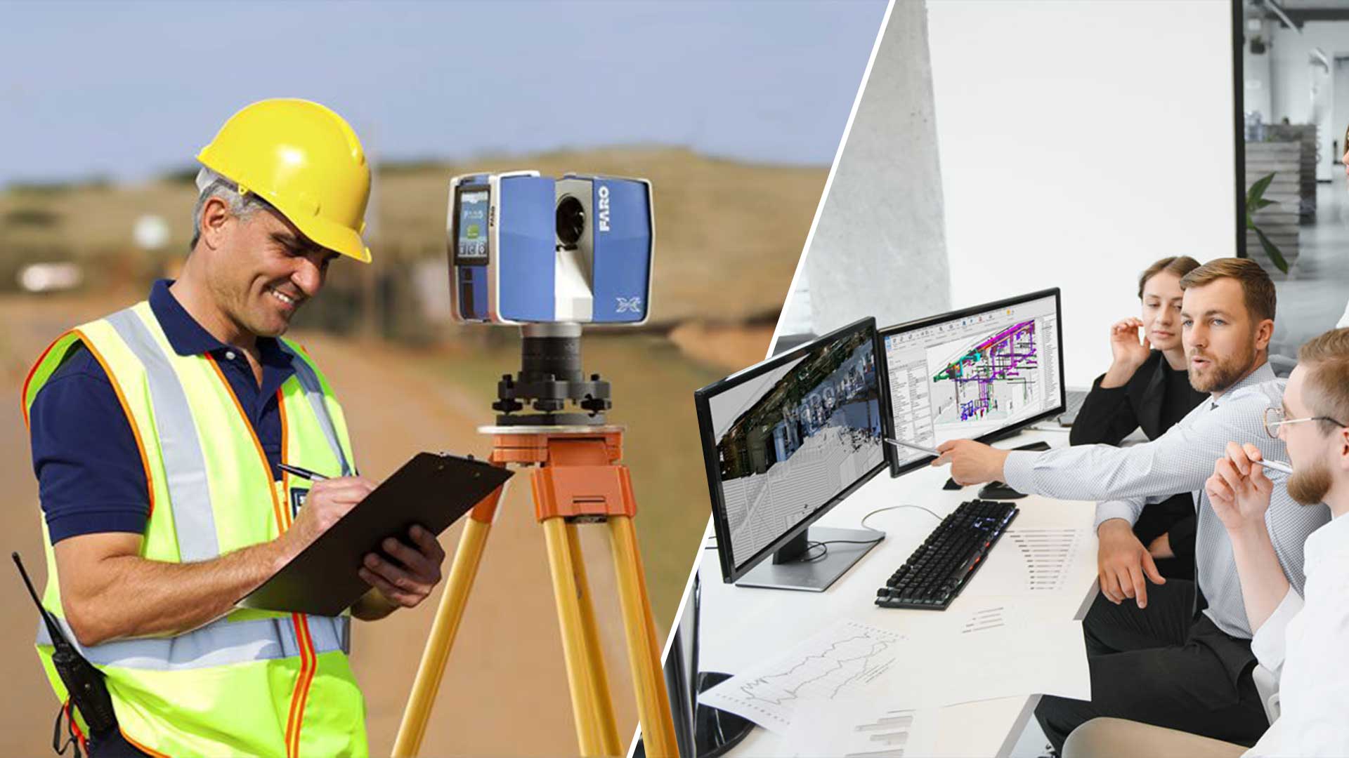
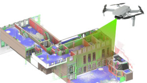
Surveyors are responsible for measuring and mapping out the physical world. They use tools like total stations, GPS, and laser scanners to collect accurate data about a site. Laser scans to BIM services are a key part of this process, as they involve capturing detailed 3D data of the site and converting it into digital models. This data includes everything from the layout of the land to the positions of existing structures. Their goal is to provide an accurate foundation for the BIM model.
On the other hand, BIM Modelers take this raw data and turn it into detailed digital models. These models help visualize the final project and can be used for planning, design, and even future maintenance. BIM modelers use software like Revit and Navisworks to create and manage these models, integrating data from various sources to ensure everything fits together correctly.
Collaborative Workflow
For surveyors and BIM modelers to work well together, they need to establish clear communication and a shared workflow. This begins with initial coordination, where both parties set goals and decide what data and deliverables are needed.
Data Sharing and Integration is a crucial part of this process. Both of them must agree on how data will be shared. This means choosing compatible formats and tools for exchanging information. Common formats include IFC and DWG, which help ensure that data from surveyors can be easily used in BIM software.
Regular meetings and updates are essential. Scheduling these meetings helps keep everyone on the same page. It’s important to share progress and address any issues as soon as they arise to avoid delays.
Data Accuracy and Quality
Accurate data is vital for creating high-quality BIM models. If the survey data is incorrect or incomplete, the resulting model will be flawed. Therefore, surveyors need to ensure that their measurements are precise and thorough.
To maintain data quality, both surveyors and BIM modelers should use best practices for data collection and entry. This might involve validating data with additional checks or cross-referencing with other sources. By paying attention to detail and ensuring accuracy, both parties help create a more reliable and effective BIM model.
Conflict Resolution
Sometimes, differences in data or interpretation can lead to conflicts between surveyors and BIM modelers. For example, a surveyor’s measurements might not align perfectly with the modeler’s data. It’s important to address these issues quickly to prevent them from affecting the project.
Effective communication is key to resolving conflicts. Both sides should discuss their concerns openly and work together to find solutions. Using collaborative problem-solving techniques can help ensure that any issues are resolved in a way that benefits the project as a whole.
Conclusion
Collaboration between building and land surveyors and BIM modelers is crucial for achieving optimal results in construction and design projects. By understanding each other’s roles, working together through a clear workflow, ensuring data accuracy, and resolving conflicts effectively, these professionals can create successful and high-quality projects. Clear communication and a willingness to adapt and cooperate are the cornerstones of a successful partnership.


Recent Comments