
AI-enhanced LiDAR is redefining how urban plannings are conceptualized, modeled, and managed. By combining precise spatial data with intelligent automation, urban planners and AEC professionals gain the tools to build cities that respond in real-time to environmental conditions, population dynamics, and transportation demands. This convergence drives a shift from static master plans to adaptive systems powered by data-rich modeling and performance simulation.
LiDAR generates high-fidelity, geospatially aligned point clouds that serve as the physical foundation for BIM models. When processed through AI algorithms such as convolutional neural networks or point cloud segmentation models, these datasets transform into intelligent design assets. The integration supports generative planning, predictive analysis, and operational efficiency across verticals like transit infrastructure, zoning, and energy use.
AEC firms and smart city stakeholders now rely on LiDAR scan to BIM integration with AI to meet growing demands for sustainability, resilience, and mobility innovation. Whether optimizing multimodal networks or enhancing infrastructure lifecycle management, this dual-technology approach enables faster decision-making, greater spatial accuracy, and more collaborative workflows. AI and LiDAR together form a core strategy for building data-driven, future-ready urban environments.
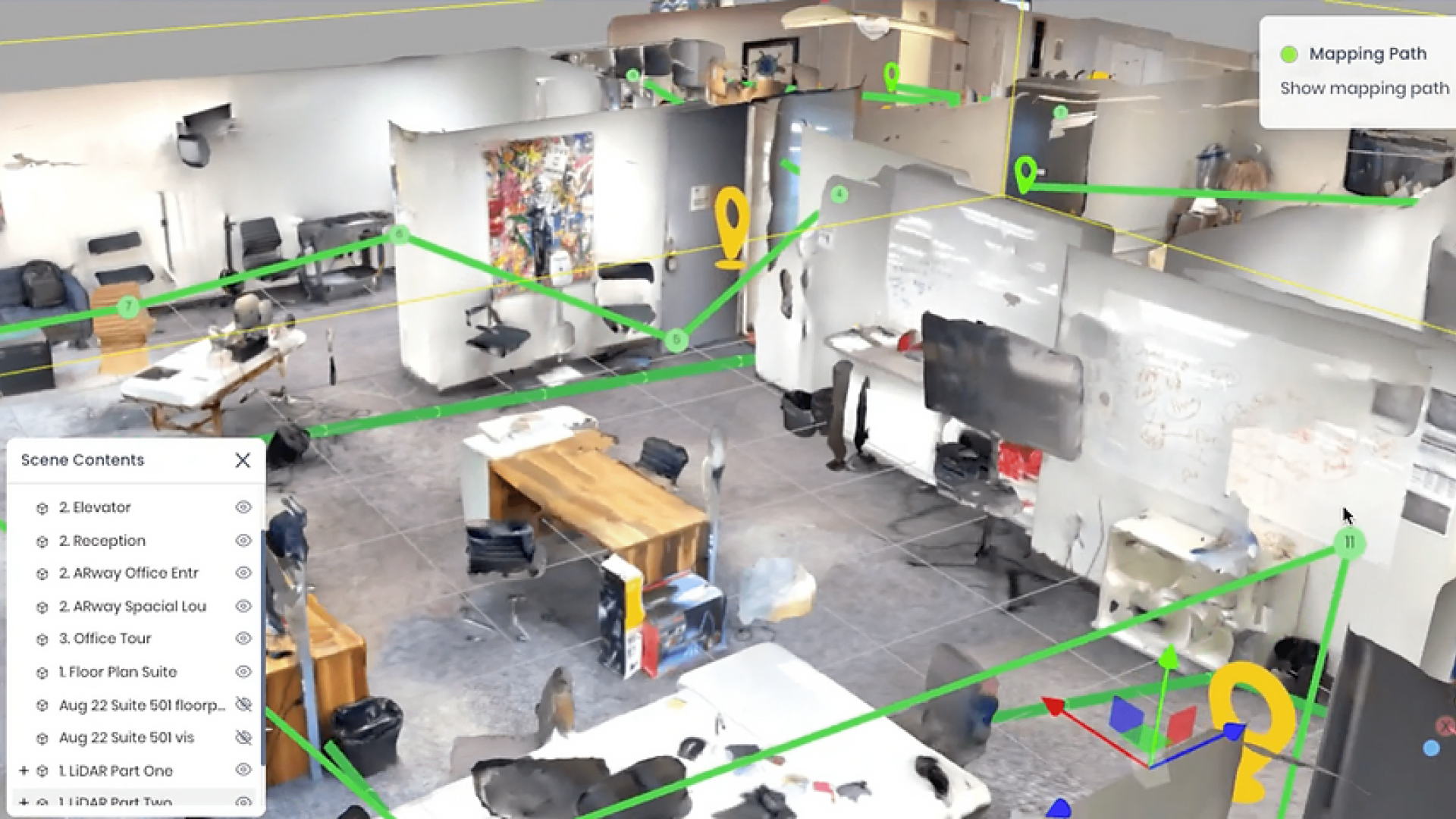
Referance: LiDAR scan in the ARway Creator Portal.
Why Urban Planning Is at an Inflection Point
Urban development now operates within a high-stakes framework shaped by rapid population growth, evolving climate goals, and the strategic mandates of ESG reporting. Mobility patterns have shifted post-pandemic, requiring greater flexibility in infrastructure planning and public space design. These demands highlight the need for systems that go beyond traditional CAD or BIM workflows, calling for real-time spatial intelligence, automation, and predictive modeling. City planners and AEC leaders are aligning digital transformation initiatives with objectives like carbon neutrality, green mobility, and adaptive zoning.
The maturity of point cloud to BIM adoption across the AEC sector has created a foundation ready for augmentation. AI and LiDAR enhance this baseline by infusing data-rich models with autonomous analysis and geospatial precision. This unlocks a new planning paradigm where urban systems are designed and dynamically programmed. Road networks, transit systems, and energy corridors become intelligent layers within a digital twin ecosystem, enabling scenario testing, lifecycle forecasting, and continuous operational feedback. The shift repositions urban design as a system-level engineering discipline, powered by integrated data and real-time decision logic.
Understanding LiDAR, AI, and Their Convergence
LiDAR in urban planning goes far beyond surface scanning it enables high-resolution mapping of urban morphologies, infrastructure geometry, and vegetative cover, all referenced in real-world coordinates. In AEC workflows, LiDAR acts as the primary data input for developing LODs 300–500 BIM models, supporting clash detection, envelope analysis, and volumetric massing within federated design environments.
AI introduces a computational layer that learns from spatial data and automates complex tasks in modeling and classification. Deep learning frameworks such as KPConv and U-Net are applied directly to unstructured point clouds, producing labeled datasets that classify utilities, pavement types, or architectural features. These systems power semantic segmentation, automate feature extraction, and support data-driven parametric modeling within platforms like Dynamo and Grasshopper.
When Laser scan to BIM physical precision merges with AI’s analytical capability, the result is a fully digitized pipeline from reality capture to predictive design. This convergence accelerates BIM model generation, enables planners to simulate zoning compliance, infrastructure demand, and modal performance all within a spatially accurate, continuously updating urban model.

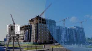
LiDAR as the Backbone of Urban Reality Capture
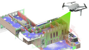
LiDAR transforms fragmented site data into a unified, measurable, and design-ready digital environment. In urban-scale projects, firms deploy mobile and aerial LiDAR platforms to simultaneously map horizontal infrastructure, subgrade utilities, and elevation-sensitive assets. This spatial intelligence is immediately actionable, enabling the creation of topologically consistent BIM models used for right-of-way modeling, utility conflict analysis, and vertical zoning validation. The data structure supports layered integration with cadastral records and zoning overlays, forming the spatial base for regulatory alignment and impact forecasting.
AEC firms now implement AI-augmented Scan-to-BIM pipelines where LiDAR data feeds into Revit families, Dynamo scripts, and infrastructure design tools without manual remeshing. Use cases extend beyond basic as-built verification. In smart mobility projects, LiDAR models support curb-level grading for micromobility lanes, evaluate real-world turn radii for autonomous shuttles, and simulate modal priority zones within BIM 360 environments. This approach ensures that digital models reflect both engineering precision and operational constraints, bridging the gap between static documentation and real-time city performance.
AI as the Intelligence Layer of Smart Mobility
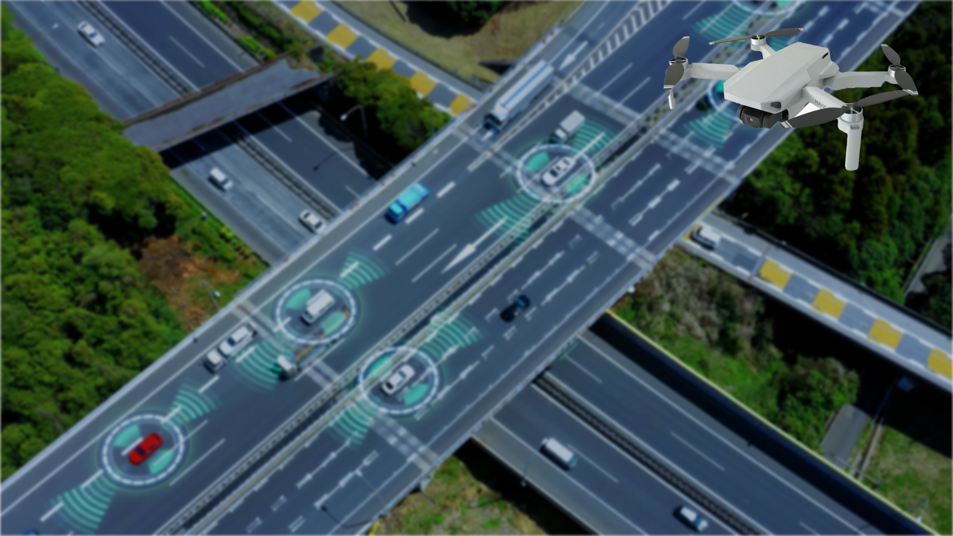
AI enables planners and AEC professionals to model mobility systems not as static networks but as dynamic, data-driven systems that respond to real-time conditions. By integrating AI algorithms with LiDAR-derived datasets, firms generate predictive models for curb space allocation, multimodal transit flow, and congestion patterns. Generative tools within Dynamo and Revit use these insights to automate the layout of road geometries, pedestrian corridors, and EV infrastructure with zoning-aware logic. When connected to simulation engines or digital twins, AI continuously refines mobility scenarios based on sensor inputs, enabling infrastructure designs that adapt to user behavior, land use shifts, and environmental performance metrics.
Advanced Urban Feature Detection Using AI
- Feature Classification from LiDAR Point Clouds
Point cloud to BIM classifiers now identify complex urban forms like cantilevered structures, tactile paving, and ADA-compliant access zones. AI models trained on city-scale datasets apply context-aware segmentation, linking spatial hierarchy to BIM object types.
- Optimization Techniques
Hybrid metaheuristics optimize semantic accuracy across occluded and multi-surface environments, reducing false positives in dense corridors. Algorithms dynamically adjust neighborhood radii and voxel resolution for terrain-sensitive classification and model-ready BIM outputs.
Integrated Workflows: The True Convergence of AI, LiDAR, and BIM
Step 1: AI-Enhanced Scan-to-BIM Conversion
Reduces manual modeling time by up to 70% using automated object recognition from classified point clouds.
Step 2: Real-Time Feature Detection and Auto-Classification
Achieves 92%+ accuracy in segmenting urban elements like curbs, signage, and utilities for direct BIM import.
Step 3: Federated Digital Twin Assembly
Combines LiDAR, BIM, and sensor data to build digital twins that update in real time across asset lifecycles.
Step 4: Cross-Platform Spatial Intelligence Integration
Links Revit, ArcGIS, and Unity Reflect to enable zoning validation and geospatial analytics within BIM workflows.
Step 5: Simulation and Operational Feedback Loop
Enhances infrastructure performance by 40–50% through AI-driven simulations of mobility, energy, and usage data.
Challenges to Implementation
Model Drift in AI-LiDAR Workflows
Continuous urban development can cause trained AI models to lose accuracy over time, requiring periodic retraining with updated LiDAR inputs.
Real-Time Data Synchronization
Integrating high-frequency LiDAR scans into live BIM or digital twin environments introduces processing and network latency challenges.
Semantic Inconsistency Across Urban Datasets
Inconsistent classification schemas between municipal GIS, AI outputs, and BIM libraries hinder automated model convergence.
Multi-Resolution Conflict in Federated Models
Merging drone, terrestrial LiDAR, and legacy CAD inputs creates alignment conflicts at varying resolutions and scales.
AI-Agent Coordination in Multi-Stakeholder Environments
Deploying multiple AI systems traffic, zoning, environmental; requires orchestration logic to prevent contradictory spatial outputs.
Future Trends and Innovation Roadmap
Next-gen urban systems will use multi-sensor fusion combining hyperspectral LiDAR, thermal imaging, and edge-deployed AI models. It supports autonomous infrastructure diagnostics and predictive zoning recalibration. Interoperability protocols will extend beyond ISO 19650 to include real-time model handshakes between BIM 360, ArcGIS Urban, and Unreal Engine-based simulation cores, enabling continuous environmental response modeling. Urban digital twins will evolve into physics-aware, agent-based platforms capable of simulating carbon flux, microclimate shifts, and energy redistribution in response to infrastructure use patterns, transforming cities into fully programmable, self-optimizing environments.
Closing Perspective
AI and LiDAR now serve as active design partners in shaping high-performance urban systems. Their integration transforms BIM into a dynamic intelligence layer enabling real-time responsiveness across planning, infrastructure optimization, and environmental modeling. With automated classification, predictive simulation, and spatial analytics operating in sync, cities become programmable environments that continuously align with mobility goals, sustainability metrics, and human-centered design. By investing in cross-functional urban intelligence teams skilled in AI, geospatial data, and BIM; AEC leaders and city stakeholders position themselves to lead the development of adaptive, efficient, and future-ready urban landscapes.


Recent Comments