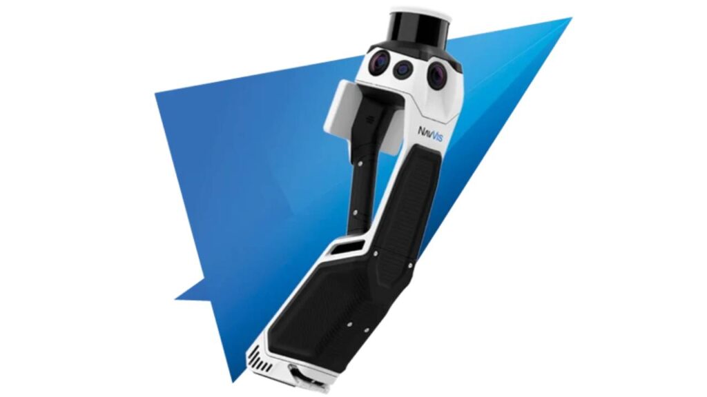
NavVis Scan to BIM
Our NavVis Scan to BIM services provide cutting-edge solutions to capture real-world environments and convert them into accurate digital models. We combine expertise, advanced technology, and reliable software to deliver high-quality results tailored to your project needs in architecture, construction, and real estate.

Cost-Effective Solutions with NavVis Scan to BIM
As a trusted provider of Scan to BIM services in the USA, we pride ourselves on delivering accurate, high-quality solutions to meet the diverse needs of our clients. Our team is dedicated to bridging the gap between the physical and digital worlds, offering advanced scanning services powered by NavVis technology. With years of experience, we have become a go-to partner for projects requiring precise and reliable digital documentation.
At the core of our services is the NavVis scanner, a cutting-edge tool that redefines efficiency and accuracy in data capture. These scanners allow us to collect detailed 3D data from any environment, whether it’s a historical building, a commercial structure, or a construction site. By integrating this technology into our workflow, we ensure that our clients receive exceptional results that align with their specific project requirements.
What sets us apart is our ability to tailor NavVis technology to each client’s unique goals. Whether you need detailed floor plans, clash detection for construction projects, or high-definition 3D models for visualization, we adapt our methods to suit your needs. Our commitment to quality and customer satisfaction makes us a reliable partner in leveraging NavVis scanners for your projects.


Our Scan to BIM Expertise With NavVis
Our team is equipped with the expertise to handle NavVis scanning equipment for projects of any complexity. From intricate architectural designs to large-scale construction sites, we have successfully delivered tailored solutions. Our experience ensures that each project benefits from high-quality point cloud data and smooth BIM integration.
- Proficient in using NavVis VLX and M6 scanners.
- Experience with architectural, construction, and real estate projects.
- Expertise in managing large-scale and complex projects.
- Customized solutions to meet specific client needs.
- Collaborative approach with architects and contractors.
How We Use NavVis Scanners Data?
Our process for utilizing NavVis scanner data is designed to ensure precision and efficiency at every stage. First, we use NavVis scanners to capture detailed point cloud data of the physical environment, creating an accurate digital representation. This raw data is then processed using advanced software like Revit and Recap, where it is refined, aligned, and optimized for modeling.
Once the data is processed, our team transforms it into highly accurate BIM models tailored to your project’s needs. Whether it’s for architectural planning, structural analysis, or facility management, we ensure that the final outputs are detailed, easy to integrate, and ready for immediate use. This streamlined workflow enables us to deliver dependable, high-quality results that save time and enhance project outcomes.
Capabilities of Our NavVis Scan to BIM
- High-definition, accurate digital representations for planning and visualization.
- Detailed models for structural, architectural, and MEP components.
- Reliable floor plans and elevations for new and existing buildings.
- Identifying and preventing conflicts across project components.
- Easy integration with CAD and BIM platforms.
- Faster project turnaround, reducing costs through precise data capture.
- Accurate documentation for heritage site restoration.
- Enabling space planning and maintenance with accurate models.
- Improved communication through shared digital models and data.
- Faster processing for quicker decision-making.
FAQS
We capture data from NavVis scanners, including the NavVis VLX and NavVis M6 models. These advanced scanners are capable of capturing high-precision point cloud data in a range of environments, from complex buildings to expansive outdoor sites.
We capture detailed point cloud data, which is a collection of 3D coordinates that represent the physical environment. This data serves as the foundation for creating accurate digital models of buildings, structures, and landscapes.
Once we capture the point cloud data, it undergoes a detailed processing stage using industry-standard software like Revit and Recap. This includes data alignment, refinement, and optimization to ensure the highest level of accuracy before converting it into BIM models.
After processing the data, we deliver comprehensive BIM models that include all the necessary structural, architectural, and MEP details. We also provide as-built floor plans, elevations, and any additional visual documentation required for your project.
Using NavVis scanner data helps provide highly accurate and detailed 3D models that improve design accuracy, reduce errors, and enhance project collaboration. By capturing real-world data, we ensure that the digital models reflect the true conditions of your site, allowing for more informed decision-making throughout the project lifecycle.
Yes, we can work with point cloud data captured by other scanner brands as well. However, we specialize in data captured by NavVis scanners due to their superior accuracy and efficiency, which enhances the quality of the final BIM models we produce.
The time required to process the captured data depends on the size and complexity of the project. On average, it can take anywhere from a few days to several weeks to process the data and deliver the final BIM model, ensuring all details are accurately captured and integrated.
