Point Cloud
What is Point Cloud?
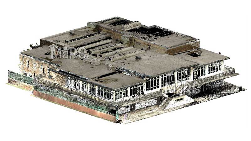
A Point Cloud is a collection of data points defined in a three-dimensional coordinate system. These points represent the external surface of an object or space and are typically generated by 3D scanners or photogrammetry. They serve as the foundational data for creating 3D models, enabling applications in fields like architecture, engineering, and construction for visualization and analysis.
Understanding Point Clouds
Point clouds consist of many individual points, each defined by X, Y, and Z coordinates in a 3D space. These points are usually collected using 3D scanners, which can be based on technologies like LiDAR, photogrammetry, or structured light. The main purpose of a point cloud is to capture the shape and size of objects or environments in a highly detailed manner. This data helps create digital 3D models, which are useful for analysis, design, and simulation.
Types of Point Clouds
LiDAR (Light Detection and Ranging) uses laser pulses to measure distances to a surface, creating a precise 3D representation.
Photogrammetry involves taking multiple photographs of an object or area from different angles, then using software to reconstruct the 3D coordinates.
Structured Light Scanning projects patterns of light onto a surface and captures the distortion of these patterns to create a point cloud. Each method has its own advantages and is chosen based on the specific requirements of the project.
Application of Point Cloud
Architecture and Construction
Point clouds help create accurate 3D models of buildings and construction sites. They assist in designing new structures, planning renovations, and monitoring construction progress.Engineering and Manufacturing
Point Clouds are used to design parts and products, check their accuracy, and ensure they fit together correctly. It is also helpful in creating digital models of existing parts.Geographic Information Systems (GIS)
Point clouds help make detailed maps and models of landscapes. They are useful in planning cities, studying the environment, and managing natural disasters.Benefits of Point Cloud
- Point clouds capture detailed and precise measurements for accurate models of objects and spaces.
- They save time by reducing the need for manual measurements to speed up the data collection process.
- Point clouds provide clear and detailed visualizations to make it easier to see and analyze fine details.
- They help preserve accurate digital records of objects and sites, which is useful for future reference and historical preservation.
- Point clouds are versatile, being used in various industries such as construction, engineering, and healthcare.
- They support better decision-making by providing precise and comprehensive data for analysis and planning.
Frequently Asked Questions (FAQs)
Specialized software like Autodesk ReCap or CloudCompare allows you to visualize point clouds in 3D. These tools enable you to explore the data from different angles and zoom in on specific areas.
They are used in fields like architecture, construction, and engineering for creating accurate 3D models and visualizations.
LiDAR uses laser pulses to measure distances to surfaces for creating precise 3D models. Photogrammetry uses photographs from multiple angles to reconstruct a 3D model.
Yes, specialized software can edit and manipulate point clouds to remove noise or highlight specific features.
Yes, BIM software can convert point clouds into 3D models. This process involves creating a mesh or surface from the point cloud data. That allows for further use in design and analysis. Our Scan to BIM services specialize in this conversion, producing detailed 3D BIM models for accurate project planning and construction.
Point clouds are widely used in architecture, engineering, construction, automotive, aerospace, and entertainment for various applications like design, inspection, and virtual reality.
While basic point cloud manipulation can be learned quickly, advanced editing and analysis may require specialized training and experience.
Point cloud files can become very large, depending on the detail and extent of the scanned area. High-resolution scans of large objects or areas can result in files that are several gigabytes in size.